Places are evidence · people make the story

Mercer County Story Atlas.

Choose a story, meet the places connected to it, and build a history trip. Every trail is a starting point—not a substitute for archival records, community memory, or current access information.

A countywide digital exhibit

History does not fit inside one building.

Mercer County's story lives in courthouses and coal towns, churches and classrooms, rail corridors and family collections. These trails connect documented historic places without pretending one route can tell every community's experience.

Open the full historic-place map →

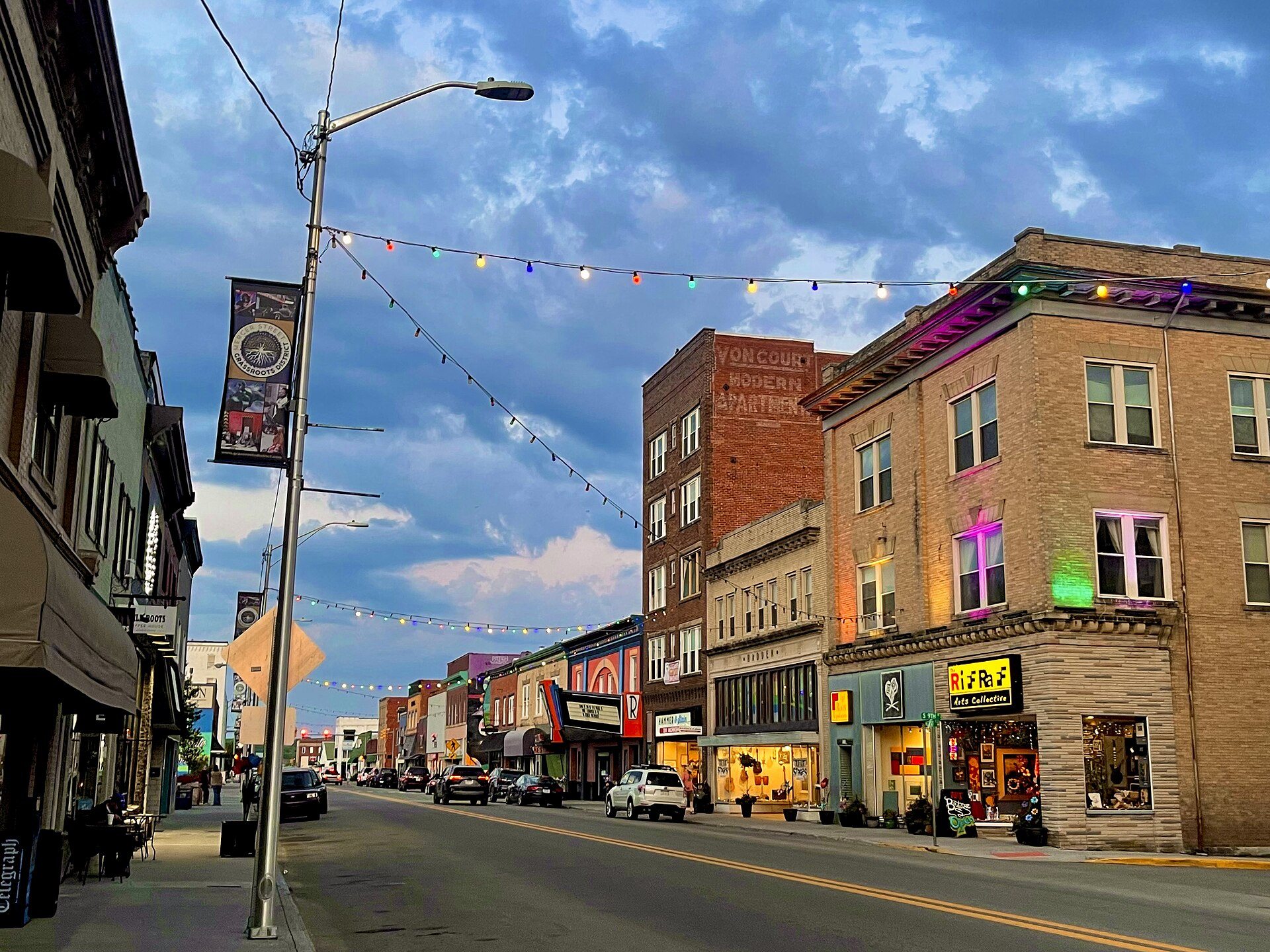
Historic buildings along Mercer Street in Princeton, West Virginia
Civic center · architecture · commerce

Princeton: county seat in motion

Begin with the courthouse and follow Princeton's civic and commercial landscape toward Mercer Street. Buildings document government, postal service, neighborhood change, and the city's evolving relationship with transportation.

  • Mercer County CourthouseCivic history
  • Former U.S. Post Office / Princeton Public LibraryCivic history
  • Mercer Street Historic DistrictHistoric district
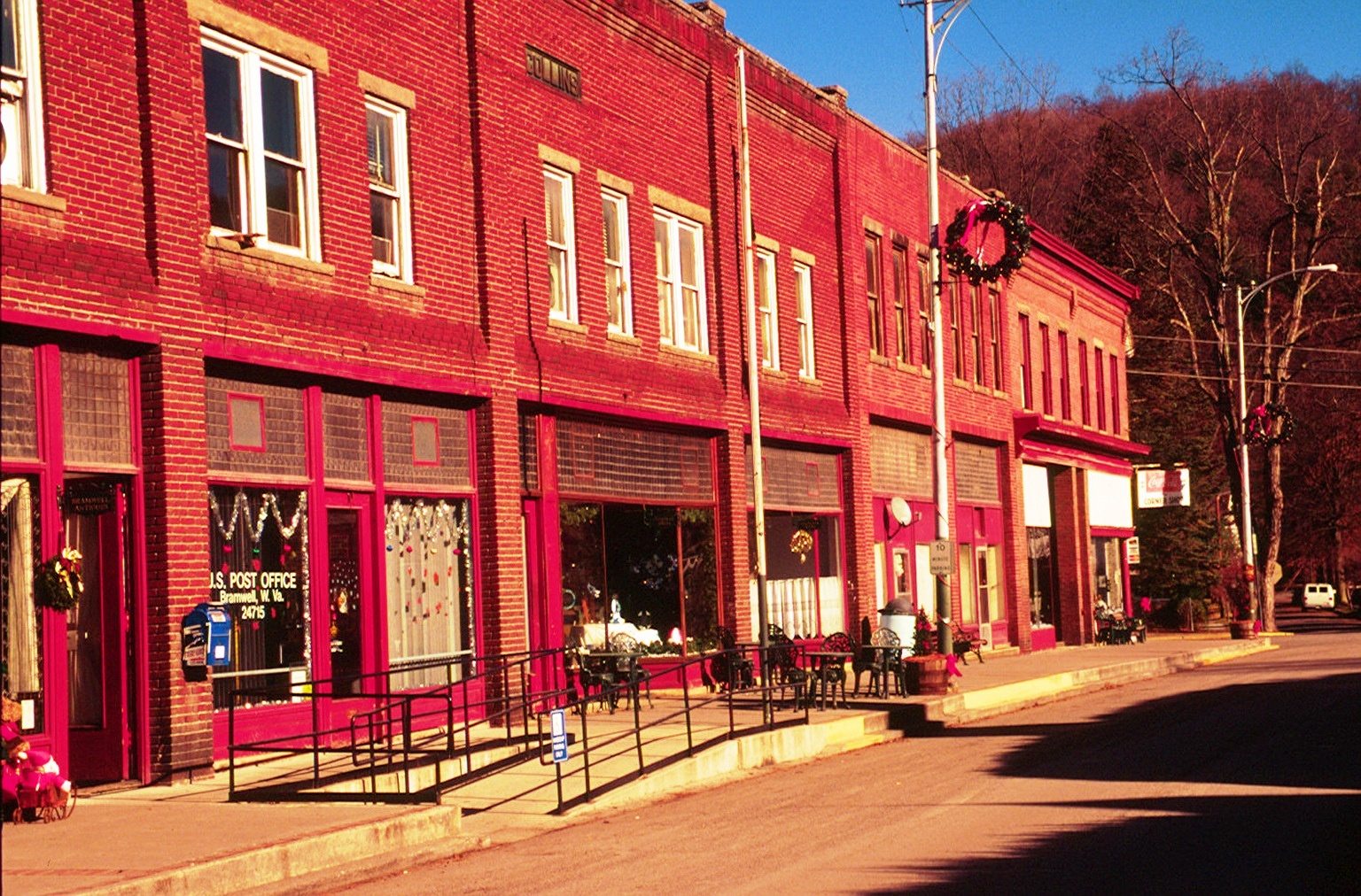
Historic commercial buildings in Bramwell, West Virginia
Industry · labor · transportation

Coal towns and rail connections

Bramwell and McComas show how extraction, capital, labor, housing, and rail transportation reshaped communities. Historic districts preserve part of that landscape; company, labor, family, and environmental records provide the fuller story.

  • Bramwell Historic DistrictCoal-town history
  • Bramwell DepotRail history
  • McComas Historic DistrictCoal-town history
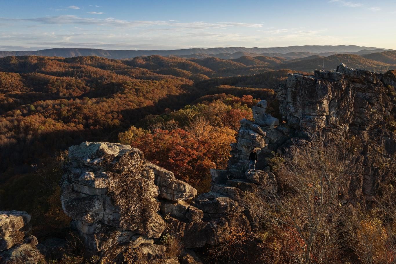
Aerial landscape view of Mercer County, West Virginia
Enterprise · faith · education · travel

African American history in Bluefield

Bluefield's National Register places connect African American enterprise, travel during segregation, churches, and education. The built environment is only one layer; oral histories, directories, newspapers, institutional archives, and family collections are essential.

  • Bluefield Green Book Historic DistrictAfrican American history and travel
  • First Baptist Church of BluefieldChurch and community history
  • Bluefield Colored InstituteEducation history
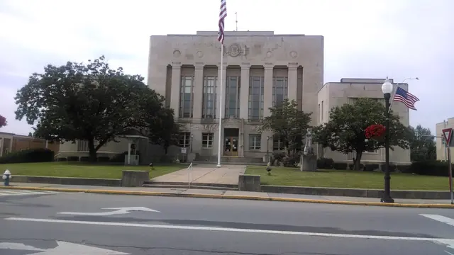
Front view of the Mercer County Courthouse and courthouse lawn in Princeton, West Virginia
Schools · public institutions · preservation

Learning, care, and civic memory

Schools and public institutions reveal how Mercer County communities organized education, care, government, and preservation. Their records can also expose whose experiences were documented, omitted, segregated, or remembered differently.

  • Montcalm High SchoolEducation history
  • President's House, Bluefield State UniversityEducation history
  • Mercer County Historical SocietyResearch and preservation
Connected chronology

Seven turning points. Many unfinished stories.

Move across county formation, war, industry, education, transportation, and preservation. Each milestone opens a source rather than presenting the timeline as the whole history.

  1. Mercer County formed

    New county lines changed government and the records families must search.

    Open e-WV source ↗
  2. Princeton campaign

    Wartime movement and fighting tied the courthouse region to wider campaigns.

    Search NPS battles ↗
  3. West Virginia statehood

    Statehood emerged from political division, war, and contested loyalties.

    Open state archive ↗
  4. Coalfield expansion

    Rail access accelerated extraction, migration, company towns, and regional change.

    Explore WVGES coal geology ↗
  5. Bluefield Colored Institute

    The institution now known as Bluefield State began under segregation.

    Open university history ↗
  6. Virginian Railway opens

    A purpose-built coal carrier made Princeton an important operating center.

    Open museum history ↗
  7. MCHS founded

    Community preservation created a countywide home for records, objects, and memory.

    Meet the Society →
Visual research journeys

Turn a trail into an investigation.

Follow four evidence steps: encounter a place, locate a record, seek a human perspective, and test the next question.

Princeton

Who shaped the county seat?

  1. Courthouse and streets
  2. Maps, deeds, directories
  3. Residents and workers
  4. Change and continuity
Coal and rail

How did extraction reorganize life?

  1. Mine and rail landscape
  2. Company and labor files
  3. Worker and family voices
  4. Costs, power, and change
Bluefield African American history

How do places recover community networks?

  1. Green Book district
  2. Directories and archives
  3. Church and campus voices
  4. Presence and omission
Education and civic memory

Whose experience entered the archive?

  1. School or institution
  2. Minutes and yearbooks
  3. Students and staff
  4. Silence and selection
Then and now

Comparison begins with matched evidence.

Open three unresolved cases where the historical record is identified and the present-day claim remains explicitly unproven.

Open the evidence desk →

How to use this atlas responsibly

Coordinates can be approximate. A mapped place may be private, altered, inaccessible, or unsafe. Confirm access before traveling; do not enter abandoned mines or cross property boundaries. Trail summaries are interpretive starting points. Follow the linked source pathways, consult MCHS records, and submit corrections through the site's editorial and corrections process.